|
Technical
Specifications
This page gives an overview of some of the gadgets we've used on a
variety of community-based GIS projects. Each of these Community-based GIS projects emerged from a
seed grant
from the northwest Academic Computing Consortium (NWACC).
With that original grant we purchased 7 PDAs, 4 PDA digital cameras, and 2
PDA GPS units. Below is some technical information on this hardware.
Our GIS analysis is conducted with several ESRI products, which the
University of Oregon owns a site license for: ArcPad, ArcPad Application
Builder, ArcView, and ArcGIS. More information on these software
packages are avialble from ESRI (www.esri.com).
|
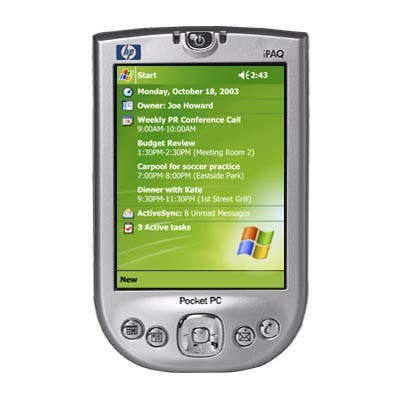 |
Ipaq 4100/4150/4155 (2 units)
- 400MHz Intel® XScale™ processor
- integrated WLAN 802.11b, Bluetooth®, IrDA
- 64MB SDRAM
- Integrated SD slot
- rechargeable Lithium-Ion (1000 mAh)
Our upgrades:
- 1800 mAh battery
- 512MB SD memory card
|
|
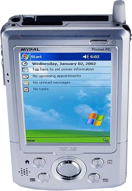 |
ASUS MyPal A716 (5 units)
- 400MHz CPU
- integrated WLAN 802.11b, Bluetooth®, IrDA
- 64MB SDRAM
- CompactFlash Type II Card Slot (3.3V)
- SD Card Slot
- 1500 mAh Lithium Ion Removable Battery
Our upgrades:
- 3000 mAh battery
- 512MB SD memory card
|
|
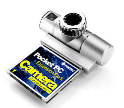 |
Pretec Pocket PC Compact Flash Camera
(4 units) The nice thing about the ASUS PDA is that it has 2
expansion slots - SD & CF. We used the SD slot for our added
512MB card. In the CF slot, we inserted this little camera so
that we could incorporate digital photos into our GIS database.
The quality isn't fantastic, but does well for 'good enough' uses.
There is no flash, so the camera is for daytime use only. |
|
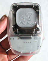 |
Pharos Bluetooth GPS (1 unit)
Because our Ipaq PDAs only had one expansion slot, and that slot
was dedicated to file storage, we purchased one of these GPS devices
that connects to the PDA via wireless Bluetooth technology.
As of December, 2004, we have not found it necessary to us GPS
for our data collection; instead we have used GIS base maps that
provided us with 'accurate enough' abilities.
|
|
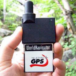 |
Teletype GPS - Bluetooth (1 unit)
We purchased one of these GPS units to fit into the compact flash
slot of our ASUS PDAs.
As of December, 2004, we have not found it necessary to us GPS
for our data collection; instead we have used GIS base maps that
provided us with 'accurate enough' abilities. |
|