Completed Tasks
Water Quality Monitoring and Analysis
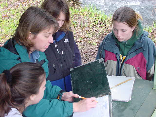
| On the first Saturday of every month Erin, Matt, and Megin, along with members of the MWP and other volunteers, go to three locations along the river and collect water samples. Once the sample are collected at the river they are taken to the Mohawk High School where the water quality testing is done. The tests include determining the water's pH value, its temperature, turbidity, dissolved oxygen, and biochemical oxygen demand (BOD). The results are recorded and compared to previous tests. By monitoring the quality of the river it helps the partnership and the citizens of the valley determine how they are effecting the river. | 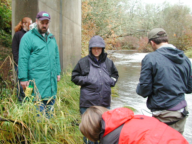 |
| During spring term, Megin charted the water quality data that has been collected by volunteers in the Mohawk valley monthly since 1998. Matt and Erin worked with Megin to interpret and explain the charts, looking particularly at any observable trends or patterns within them. The purpose of this task is to help the Mohawk Watershed Partnership better understand the data, have it in a more presentable format, and to make some preliminary conclusions about it. A stream comparison of Hamilton creek in the S. Santiam watershed was generated to help the Partnership see how their watershed collates with another similar stream. A final assessment will be given to the Mohawk Partnership which will include a chapter detailing the parameters tested, the charts and there analysis, and the stream comparison. |
Fish Traps
 |
 |
 |
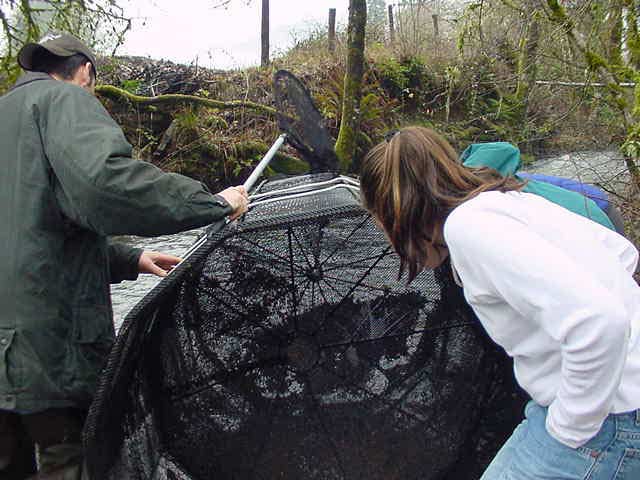
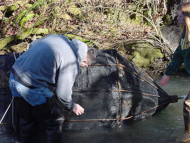
Erin, Matt, and Megin have been checking the fish traps that are at three locations in the Mohawk valley. One location is at McGowan Creek, another location is near the high school in Cartwright Creek, and the third location is at Parson's Creek. Erin, Matt, and Megin check the traps every Sunday and record the results on a data sheet that is used by other 'fish checkers'. The fish traps are checked every other day by members of the partnershipand other volunteers. The information collected is used by the Oregon Department of Fish and Wildlife. Erin, Matt, and Megin have identified cutthroat trout, rainbow trout, and sculpin fish while checking the traps.
Posters
During the fall and winter terms, each group member designed and created two educational posters, ten in all. These posters are aimed at informing Mohawk valley residents about important watershed health issues. Each poster addresses a particular issue or problem, such as invasive weed control or wildlife habitat enhancement. Furthermore, the posters let those reading know what they can do about each issue and why it is good for the watershed. To keep the focus local, every poster also includes an example of a property owner in the region who has experience with each issue. With this information, Mohawk valley residents can hopefully take action to enhance their land and raise the overall quality of land in the watershed.
Restoration Guide Booklet
During the last term, each group member met with and interviewed landowners living in the Mohawk valley. The purpose of this was to document independent restoration efforts that have taken place locally. Each interview, eleven in all, will be assembled into a booklet this term. The Mohawk Watershed Partnership will use this bookelt to encourage others to do restoration projects on their property. Also included in the booklet will be a landowner’s guide to small grants made available for restoration efforts.
Assessment of Illegal Dumping and Watershed Cleanup Day
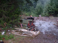
| Illegal dumping is one of the constant problems in remote areas near human populations. Dave and Andrew have explored all the public roads in the McGowan Creek sub-basin in an effort to catalog such dumpsites. Sites were mapped on a Bureau of Land Management base map and documented using a digital camera and recording GPS coordinates. A corresponding Excel spreadsheet has been created that includes GPS coordinates, site number (matches with maps), cleanup priority, nature of the trash/litter present, and the amount of equipment needed to remove the trash. This information will be used to coordinate a cleanup day in the McGowan sub-basin. The cleanup, called “Down by the Riverside", is scheduled for Saturday May 17, 2003 and is being co-sponsored by the Mohawk Watershed Partnership and Stop Oregon Litter and Vandalism (SOLV). Volunteers from the community are strongly encouraged to participate.
|
Comprehensive Study of Recreational Impacts
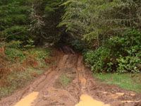
The McGowan Creek sub-basin
is used by for a variety of recreation activities, including hunting,
target shooting, off-road vehicle (ORV) riding, hiking etc. Based
on our investigations, target shooting and ORV riding are the two
most common recreation uses in the sub-basin and these activities
also have the greatest impacts on the landscape. Currently, the
BLM has no established ORV riding trails in this sub-basin, yet
we found and mapped a number of areas where “rogue”
trails have been established. These trails contribute to erosion
problems and topsoil loss, particularly in areas where they traverse
steep slopes. It is apparent that efforts have been made to close
off such trails quickly by blocking the trailheads with large logs,
boulders, or dirt mounds. The BLM has designated approximately 6000
acres of riding areas with about 18 miles of trails in an area of
the Shotgun Creek sub-basin.
|
Survey During the winter term, Steve, our project coordinator, drafted
a survey to be sent out to the approximately 1600 residents of the
Mohawk valley. Steve worked closely with the Mohawk Watershed Partnership
(MWP) to determine the focus of the survey. The survey was created
to help the Partnership better understand the level of knowledge
among residents about the Partnership and watershed issues. Also,
the survey sought to evaluate the level of involvement among residents
in watershed restoration. |
Mohawk Valley background research
Our first task for the project was to research background information on the Mohawk valley. Each group member had a particular field of interest, with topics ranging from economic development to agriculture to illegal dumping. During winter term and the first part of spring term, Matt has been working to assemble this information into a coherent whole. This information has become the first chapter of our final report.